Lignano weather forecast in real time
Weather live from the beach in Lignano with forecasts and updated information every 8 seconds:
The weather conditions and the weather situation are constantly being recorded by our weather station which has been placed in a strategic position on the beach of Lignano. The sea location has a very special micro climate with sunny skies while further inland you can find cloudy or even rainy situations. In this section you can retrieve the current weather conditions in various and special ways:
- Temperature: current air temperature
- Apparent temperature: The temperature, that is really perceived; it is calculated using a combination of air temperature and humidity.
- Apparent warmth: calculated using temperature data and humidity values (valid for temperatures above 17°C)
- Sea water temperature
- UV Index:
Intensity – values from 1 to 10, indication of times of the days when it is advised against sun tanning or when you should only take sun baths using high sun screen protection. Elevated risk for values between 6 > 7,9: Risk factor for light skin types in the following time periods: in the morning 10.30 a.m. > 11.30 a.m. and in the afternoon 3 p.m. to 4 p.m. High risk for values between 8 > 10: UV rays are very dangerous and can damage your skin and your health. The time periods are valid from 12 p.m. > 2.30 p.m. (Clouds or cloudless skies are considered in the index calculations) - Intensity of sun rays:
Sun rays that reach our planet because of the fusion occurring in the sun; June, July and August are the months in which the distance between earth and sun is the least, thus, the rays are the most intense. - Wind direction, wind force, speed of wind gusts
- Index of humidity
- Air pressure
- Amount of precipitation
- Ceiling
- Index of fire hazard
Weather Live
Weather forecast
Webcam

Live weather in Lignano Sabbiadoro
The current weather situation in Lignano is also captured by our webcams, that transmit live pictures in real time from all three locations: Sabbiadoro, Pineta und Riviera.
All important data, registered by our weather station, can be analyzed due to the atmospheric evolution of the past days; this is possible thanks to the detailed graphs and tables that show the development of the atmosphere. The weekly weather forecast also shows forecasts for the coast and the sea location. Those are very accurate because they are being analyzed by the regional weather center of Friuli “OSMER FVG” , which is monitoring the weather in the region Friuli Venezia Giulia.

Do you want to see all webcams? Discover the Webcam Live

Current weather
 13.1°C
 14.8°C
Data: 06 April 2026 - 06:06:10
(
updated 0 seconds ago)
Station Online!
Temperatures
| Temperature: |
13.1°C 
|
| Apparent Temperature: | 12.3°C |
| Humidex: | 13.1°C |
| Wind chill temperature: | 13.1°C |
| Sea Temperature: | 14.8°C |
Minimum temperatures | Maximum
| Maximum | Minimum | |
| Today |
15.1°C - 01:21 |
12.9°C - 05:10 |
| Yesterday |
21.0°C - 16:32 |
11.3°C - 07:05 |
| Monthly |
21.2°C 03/04/2026 |
9.7°C 01/04/2026 |
| Yearly |
21.8°C 23/03/2026 |
-1.8°C 08/01/2026 |
| Temperature compared to yesterday: |
Increasing +1.2°C 
|
Heat index | Maximum
| Maximum | |
| Today |
15.1°C - 01:21 |
| Monthly |
21.2°C - 03/04/2026 |
| Yearly |
21.8°C - 23/03/2026 |
UV Index

| UV Index: | 0.0 |
| Maximum value: | 0.0 at 00:00 |
Solar radiation
| Solar radiation: | 0 w/m2 |
| Solar radiation max: | 0 W/m2 to 00:00 |
| Total sun hours today: |
Wind
| Wind situation: | Calm |
| Speed: | 3.2 Km/h |
| Nautic speed: | 1.7 Kts |
| Direction: | 1° N (tramontana) |
| Gust: | 3.2 Km/h N |
| Dominant direction: | N |
| Avg Speed: | 3.2 Km/h |
| 10 Min Avg Wind Speed: | 0.0 Km/h |
| Average speed per hour: | 3.2 Km/h |
| Average speed today: | 2.9 Km/h |
| Max Wind Gust Today: | 11.3 Km/h 03:07 |
Humidity - Pressure
| Humidity: |
78%

|
| Barometer: |
1019.6 hPa

|
| Barometer Trend: | Decreasing values |
| Dew point: | 9.3°C |
| Air density: | 1.236 kg/m³ |
| Maximum | Minimum | |
| Humidity | 84% 02:41 | 73% 01:45 |
Clouds

Cloud Level
469 mt.
Rain
| Rain Today: | 0.00 mm |
| Rain Rate /1h: | 0.00 mm/h |
| Maximum rain intensity: | 0.00 mm/h ----- |
| Rain last hour:: | 0.00 mm |
| Rain last 24h: | 0.00 mm |
|
|
|
| Total in April: | 0.00 mm |
|
|
|
|
10 day since last rain. |
|
Sunrise Sunset

|
Sunrise: | 06:39 |
| Sunset: | 19:42 | |
| The day is 13:04 hours long | ||
|
|
||

|
Sunrise: | --:-- |
| Moonset: | 08:10 | |
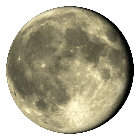
Moon Phase
Moon Phase at ᵗʰ day
Weather station installation: march 2022
Our service Meteo Live is unique in Lignano. Thanks to our professional weather station installed at the beach, you can witness the weather conditions in Lignano in real time. You can find up-dated data including graphs and tables approximately every five seconds.
These details get you informed on the current weather and the the atmospheric conditions of the past hours, days and months. Statistics on winds, temperatures, air pressure and humidity and many more parameters can be viewed right on this website. The data will be analyzed in order to get the best possible weather forecast for you.

Live Weather Radar - Rain Map
Meteorological radar with real-time rainfall map on the area of Lignano Sabbiadoro and surroundings. The Doppler radar shows the value of the reflectivity or amount of rain in the clouds with colored "zones": little precipitation in blue, while more intense and dangerous in yellow/red! it is possible to see the animation and the movement of the phenomena in the last hour by pressing the play button.
Graphics and data wheater today
Detailed graphics with data of 06/04/2026
Graphics with wind speed
Wind speed in 24h. ( km/h )
Graphics Air temperature
Air temperature in 24h. ( °C )
Graphics water temperature
Water temperature in 24h. ( °C )
Graphics UV rays index
UV rays index in 24h.
Graphics global sunray index
Value sunrays global in the last 24h. ( W/m2 )
Graphics humidity and pression
Humidity ( % ) | Pression in the last 24h. ( hPa )
Graphics rainfall
Rain rate max. in the last 24h. ( mm/h )
Graphics Not available! No rainfall yet today!
Air quality index in Lignano
Data and graphs updated on 21/02/2026 at 10:47:51
-
Particles
Pm 2.5:
3.4
µg/m³ -
Particles
Pm 10:
5.3
µg/m³
Good
Health messages
The index bands are complemented by health related messages that provide recommendations for both the general population and sensitive populations. The latter includes both adults and children with respiratory problems and adults with heart conditions.
| Air quality | General population | Sensitive populations |
| Good | The air quality is good. Enjoy your usual outdoor activities | The air quality is good. Enjoy your usual outdoor activities |
| Fair | Enjoy your usual outdoor activities | Enjoy your usual outdoor activities |
| Moderate | Enjoy your usual outdoor activities | Consider reducing intense outdoor activities, if you experience symptoms |
| Poor | Consider reducing intense activities outdoors, if you experience symptoms such as sore eyes, a cough or sore throat | Consider reducing physical activities, particularly outdoors, especially if you experience symptoms |
| Very poor | Consider reducing intense activities outdoors, if you experience symptoms such as sore eyes, a cough or sore throat | Reduce physical activities, particularly outdoors, especially if you experience symptoms |
| Extremely poor | Reduce physical activities outdoors | Avoid physical activities outdoors |
Air quality index PM10
PM10 pollutant in the last 24h. ( µg/m³ )
Air quality index PM2.5
PM2.5 pollutant in the last 24h. ( µg/m³ )
Weather forecast in Lignano
Weather forecast for up to 5 days by OSMER FVG
The Azores anticyclone is pushing towards the Alps and Italy, bringing a mass of mild, dry air that will also bring stability to our region for several days.
Data and forecasts by OSMER (regional meteorological observatory) Arpa FVG
Weather forecast for up to 6 days
General data from Italian weather server
UV index forecast for up to 6 days


UV index guide:
Intensity – values from 1 to 10, indication of times of the days when it is advised against sun tanning or when you should only take sun baths using high sun screen protection.
-
Elevated risk for values between 6 > 7,9:
Risk factor for light skin types in the following time periods: in the morning 10.30 a.m. > 11.30 a.m. and in the afternoon 3 p.m. to 4 p.m. -
High risk for values between 8 > 10:
UV rays are very dangerous and can damage your skin and your health. The time periods are valid from 12 p.m. > 2.30 p.m. -
Highly dangerous, forbidden phase index 11+:
Exposure with serious damages for the skin from 12:00 (noon) until 2.30 p.m.
(Clouds or cloudless skies are considered in the index calculations)
Wind forecasts
Wind forecasts by Windguru Cz

